Print A Map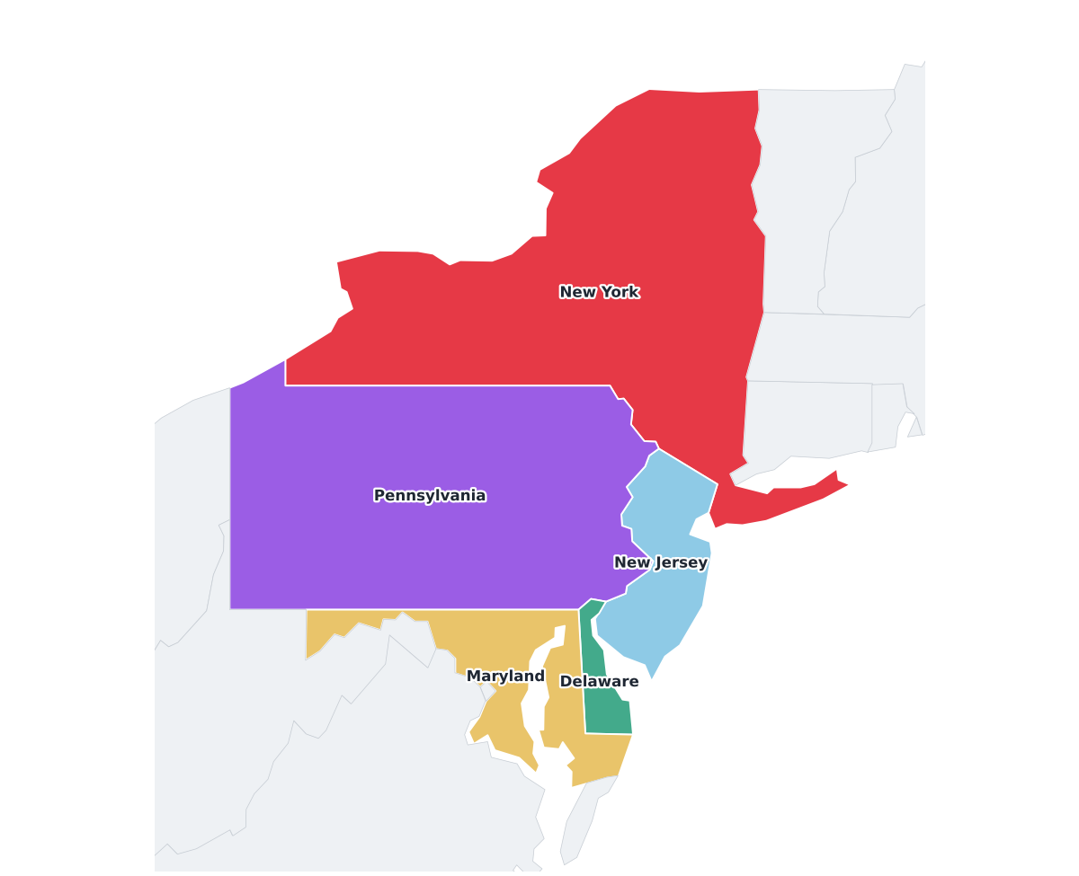
Mid-Atlantic Region Labeled Map
regionlabeled
A labeled printable map of the Mid-Atlantic region of the United States, with each of its 5 member states shaded in a distinct color and individually named on the map: New York, New Jersey, Pennsylvania, Delaware, and Maryland. Useful for regional geography lessons, business territory planning, and general reference.
Region maps like this one are useful for understanding how states group together culturally and geographically — handy for regional trip planning, business territory maps, and geography lessons that go beyond individual states.
⇩ Download Free PDF