Print A Map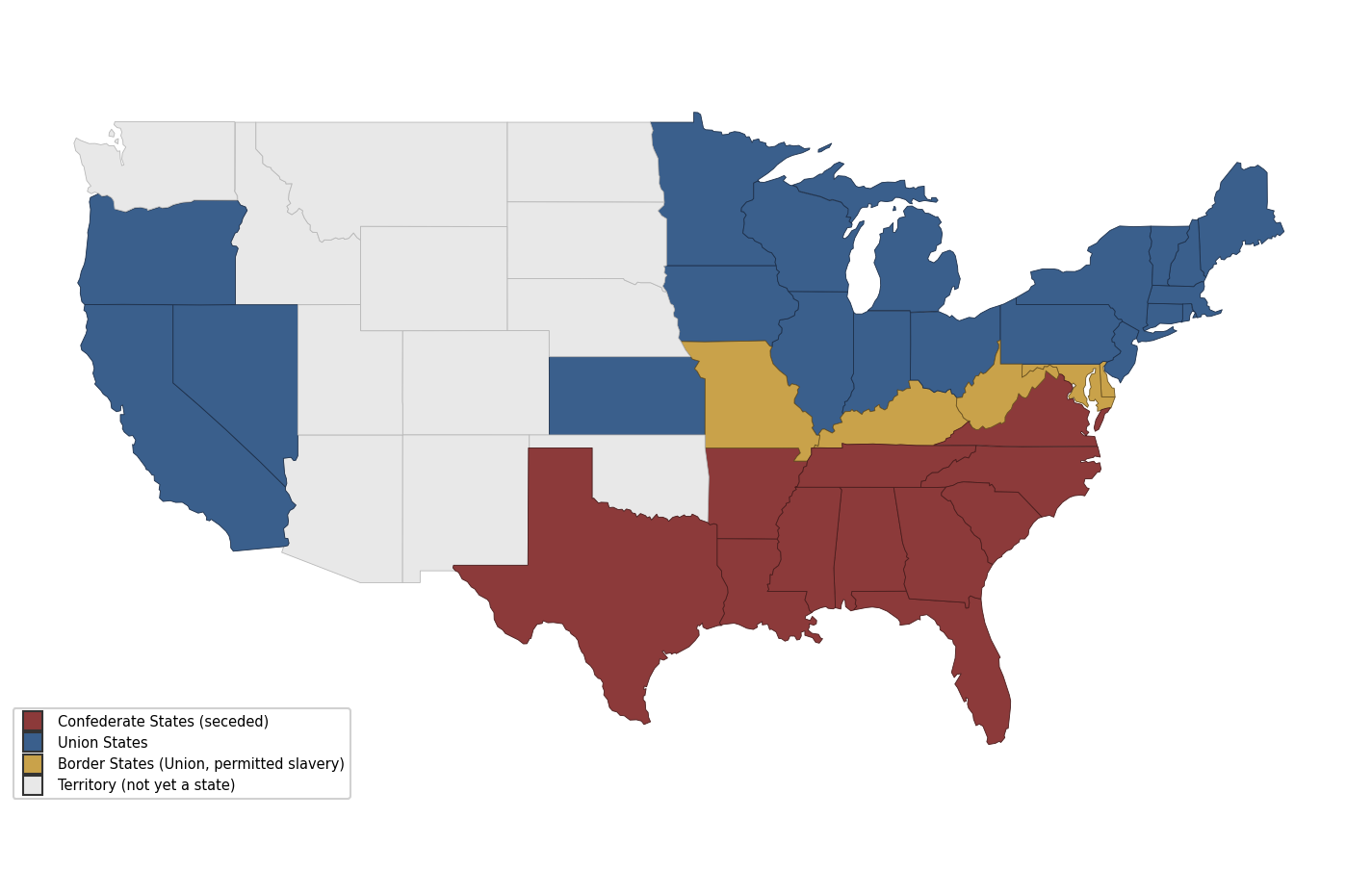
US Civil War Map
historicallabeled
A map of the United States during the Civil War (1861-1865), showing the 11 Confederate states that seceded, the Union states, the border states that stayed in the Union while permitting slavery, and the western territories not yet admitted as states — useful for US history classes.
This map is useful for history classes, reports, and general reference — print it blank or use it as a base for marking key events, battles, or cities.
⇩ Download Free PDF